Close
0%
0%

Handheld GPS Logger

a custom handheld GPS logger for mapping biodiversity in urban and suburban areas

Similar projects worth following
What if we could bring more unexpected moments of natural beauty to American urban and suburban areas? Is biodiversity a catalyst for these beautiful moments and can how can we measure it's presence?

The Handheld GPS Logger is a low-cost, hobbyist-accessible device for mapping and understanding biodiversity in urban and suburban areas.

This device was designed to help answer questions such as:
- What percentage of trees and bushes at the local public park are native to a different continent?
- What low traffic open spaces of mown grass at your local park could be converted to native grass to increase bird and insect habitat?
- Is there more biodiversity in a neglected patch of soil than an entire well maintained American suburban neighborhood?

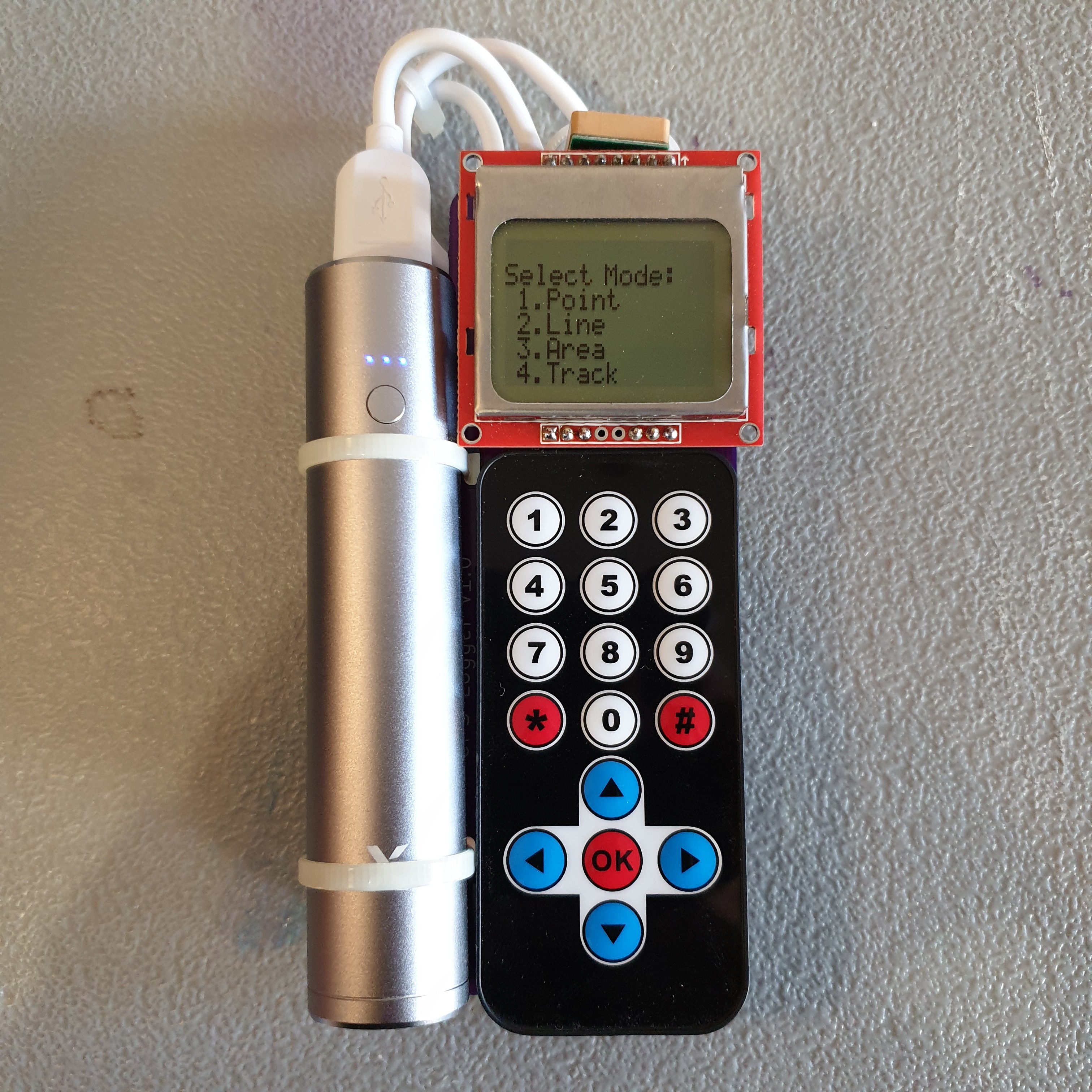
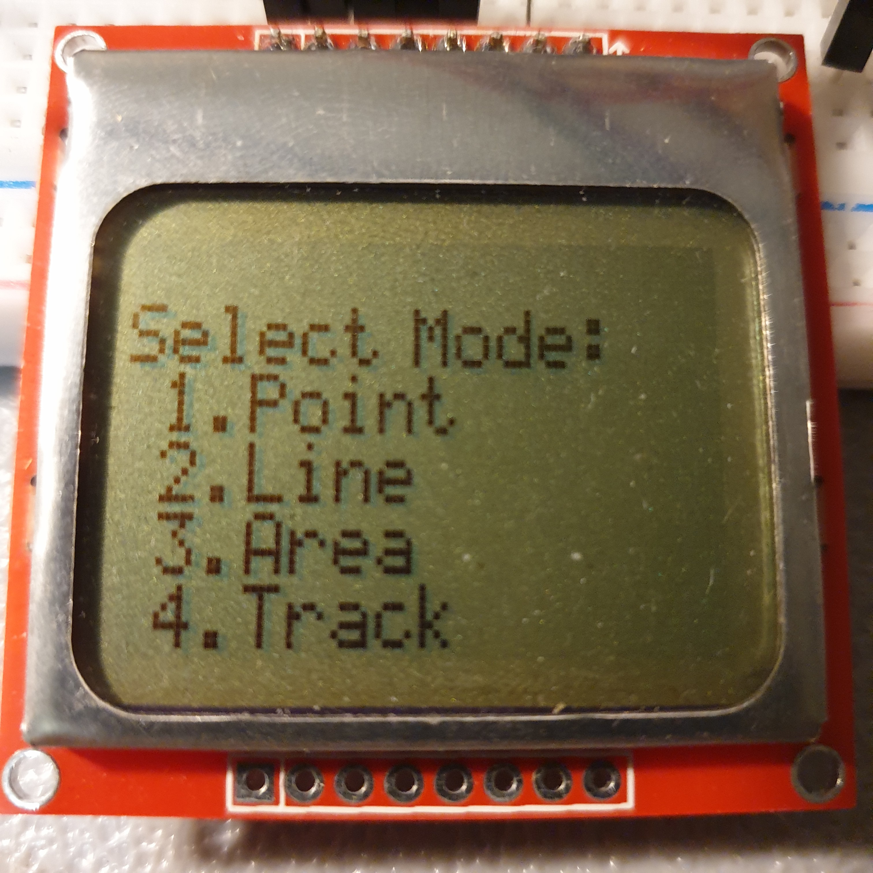
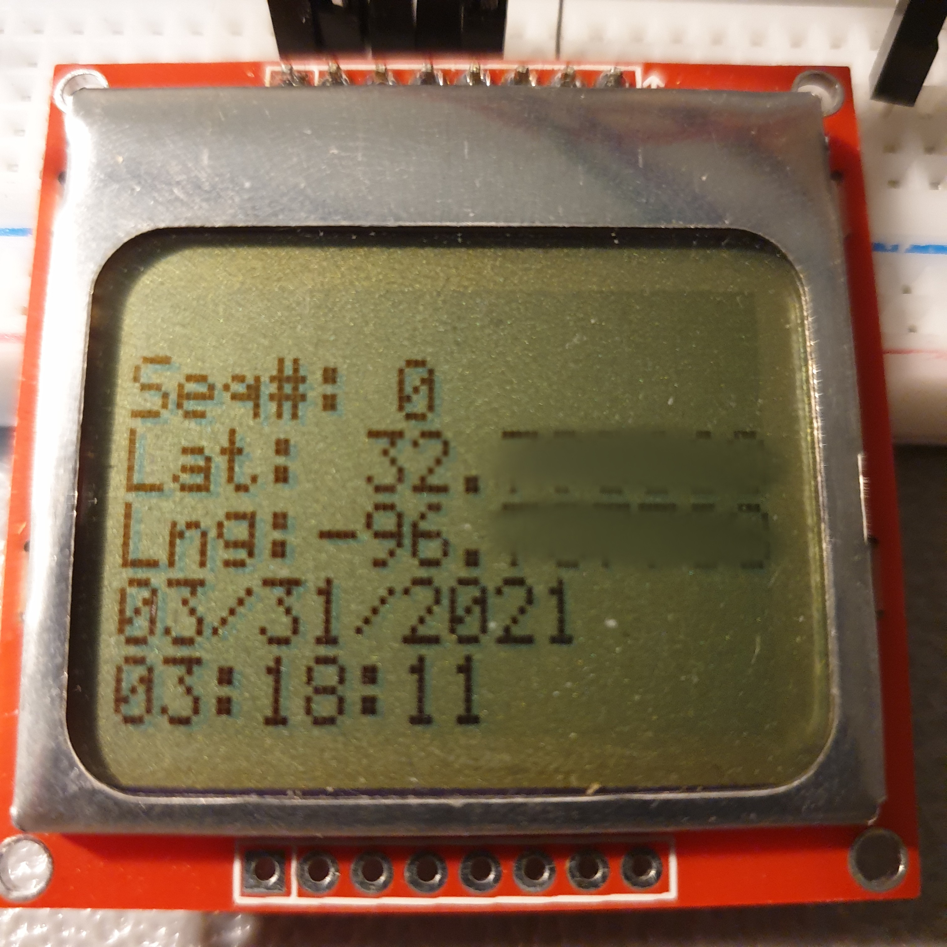
The Handheld GPS Logger has three GPS position logging capabilities:

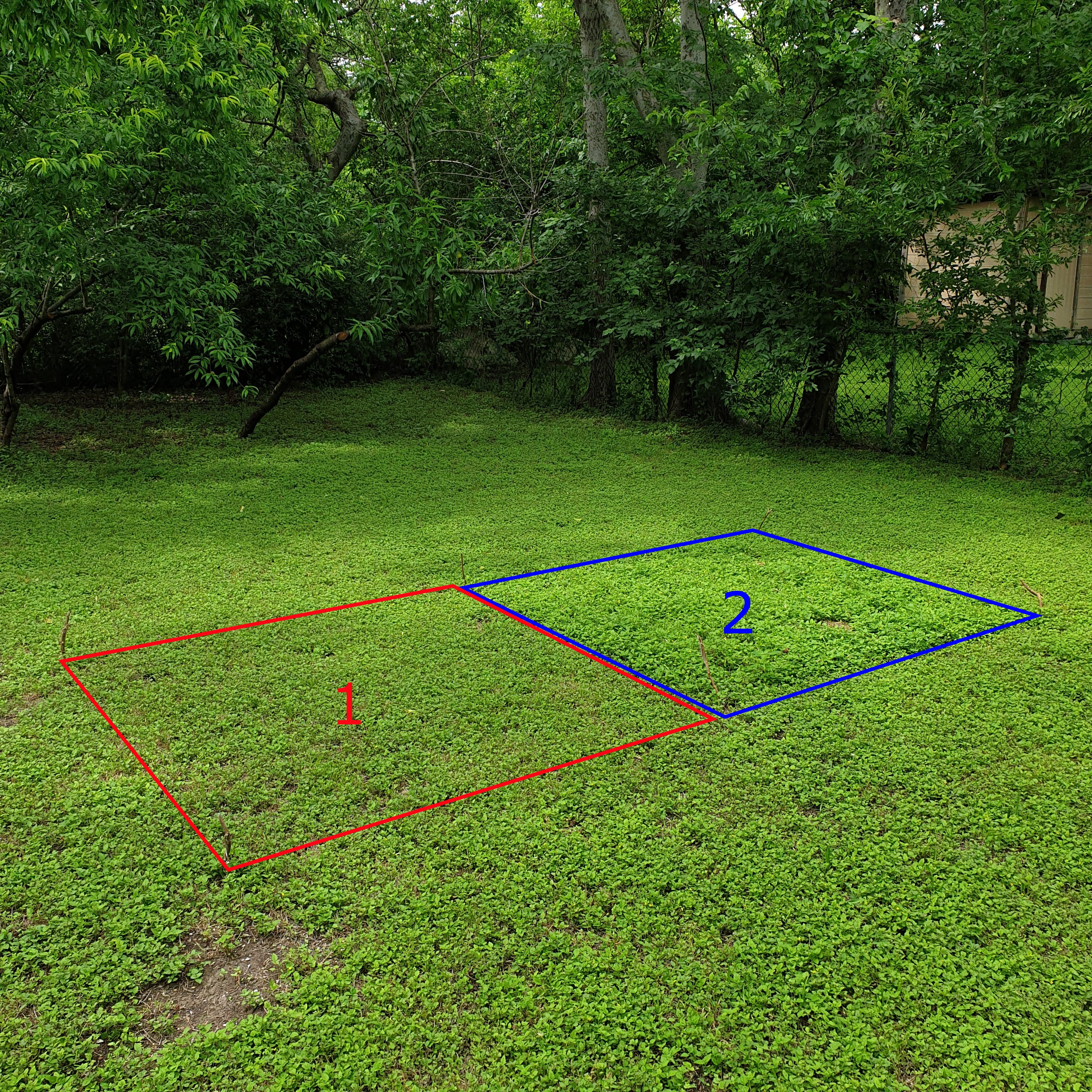
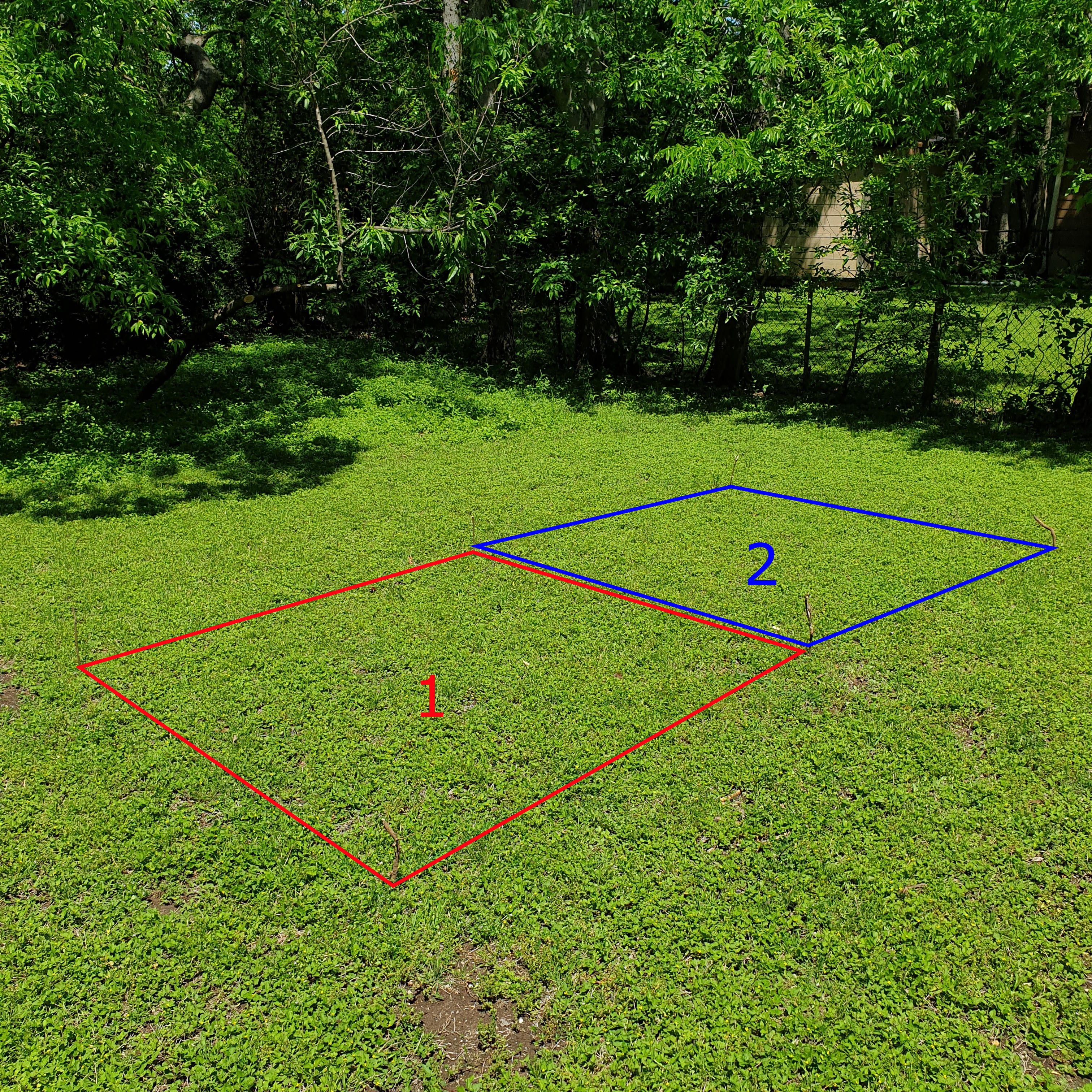
1. manual button click position logging for a single position
2. manual button click position logging for mapping borders and areas
3. automated position logging with user controlled logging frequency

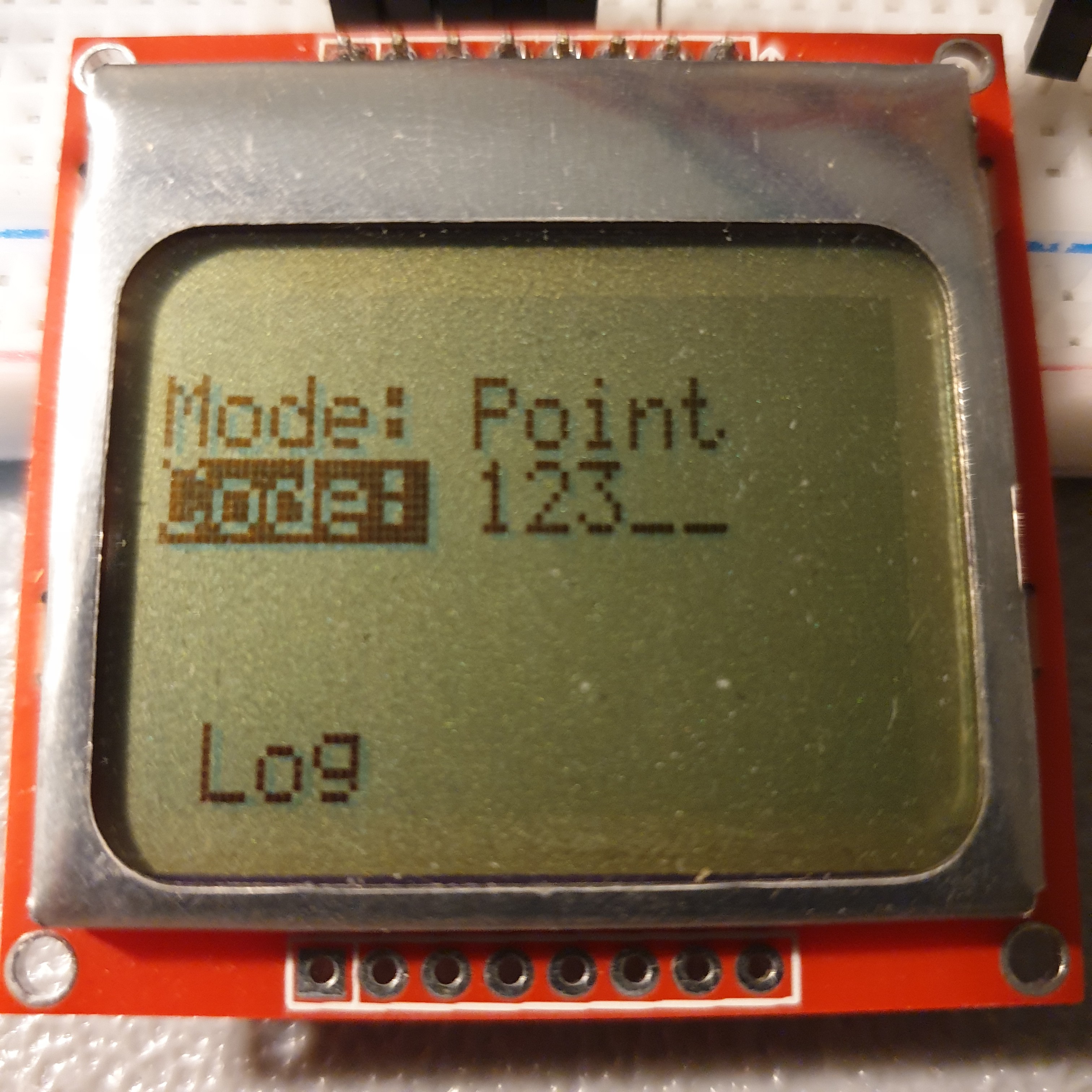
The user is given the option to assign a custom name code to each set of position data collected. 

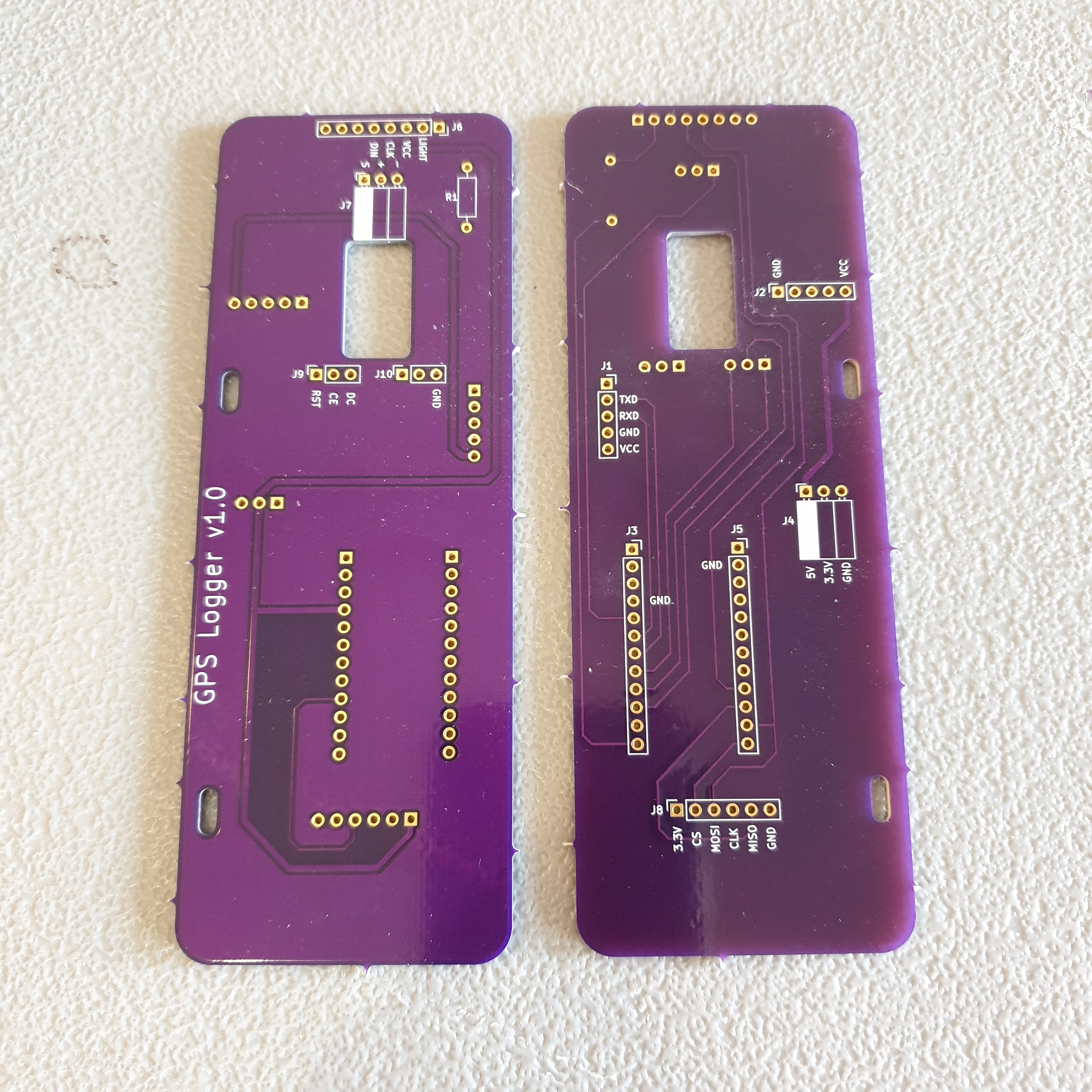
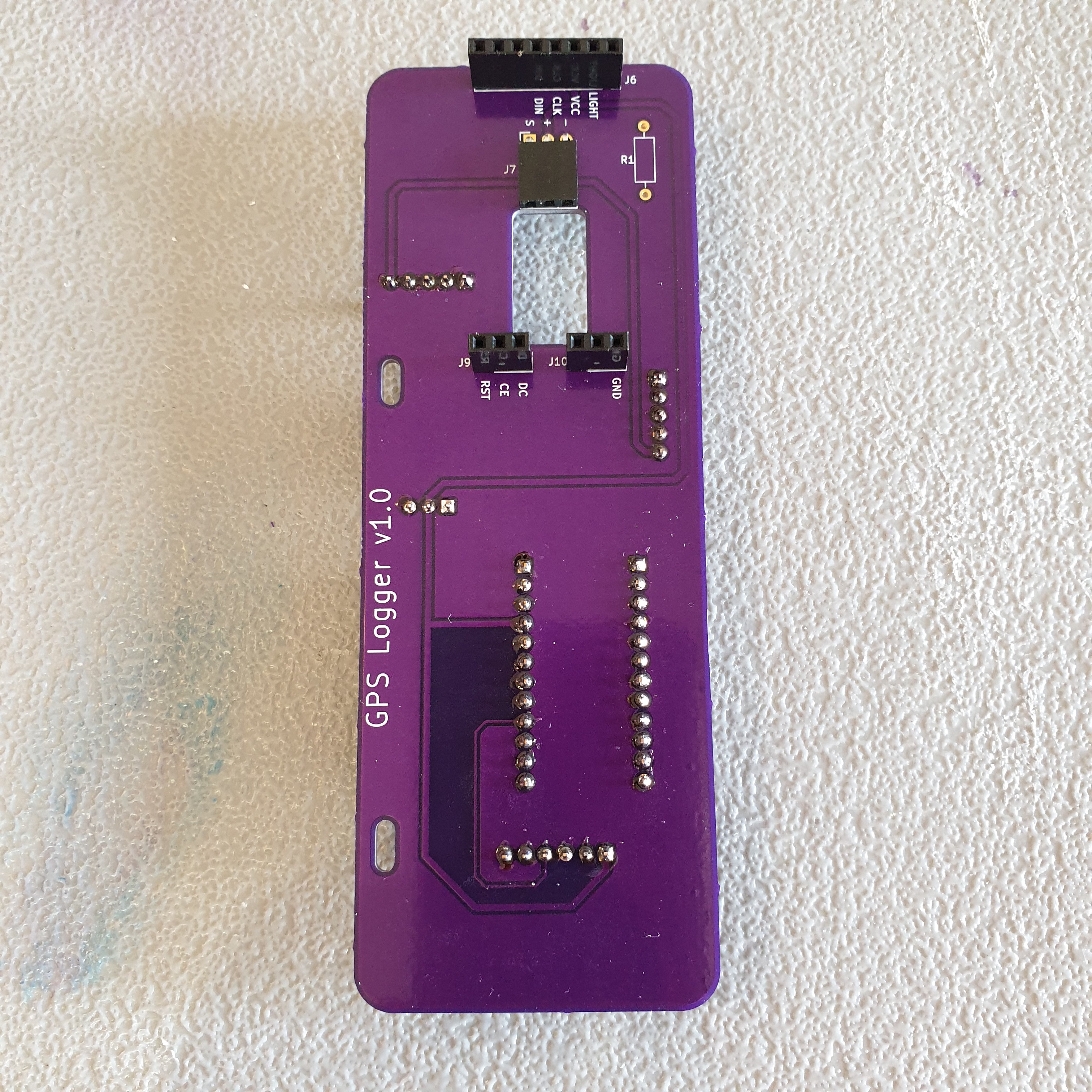
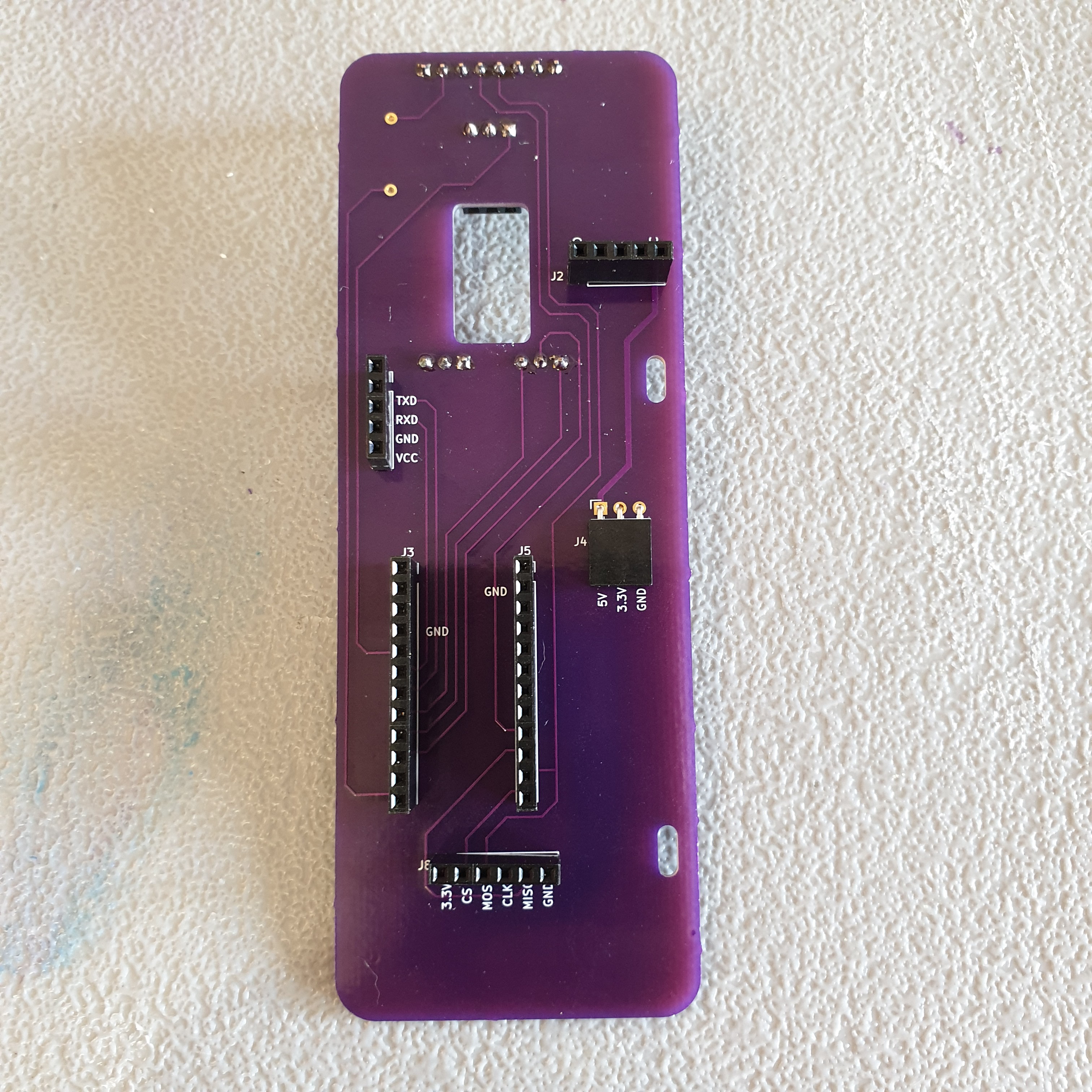
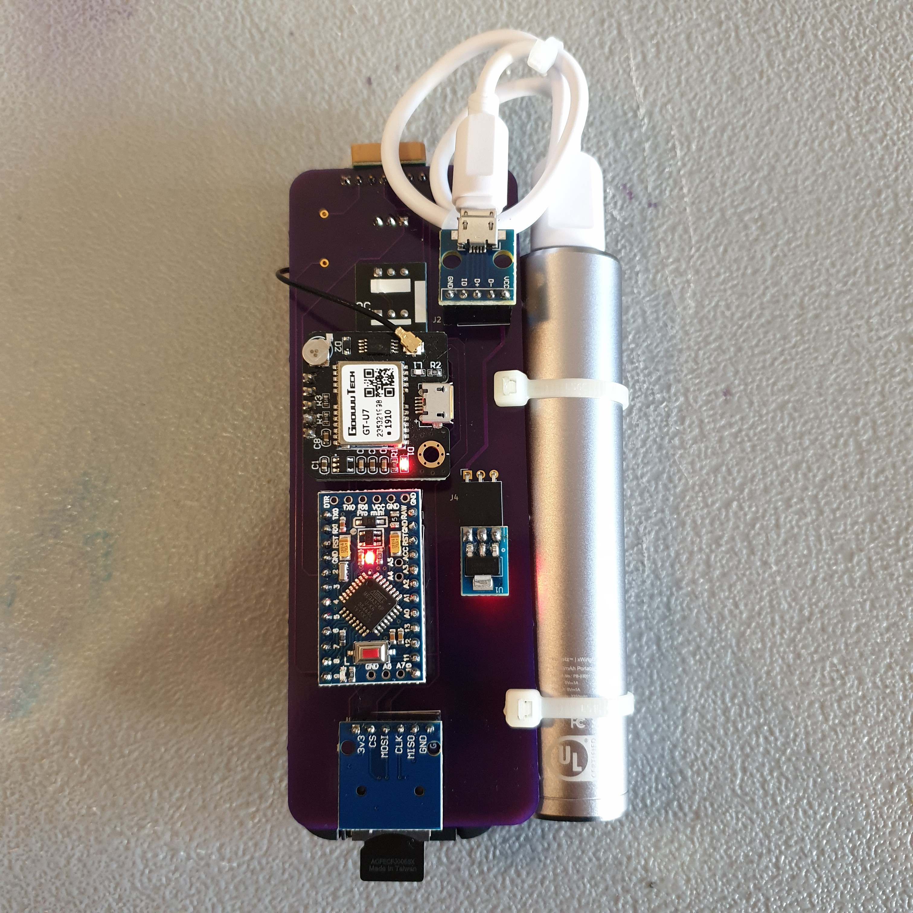
Comma separated name code, position, and time data is written to a micro SD card.

The data can be formatted as desired and uploaded to free online applications in order to generate a map.

gps_logger_v1.0.zip

GPS Logger v1.0 Arduino Sketch

x-zip-compressed - 8.77 kB - 04/10/2021 at 03:07

Download

gps_logger.zip

GPS Logger v1.0 KiCad Project

x-zip-compressed - 297.21 kB - 04/10/2021 at 03:04

Download

GPS_Logger_v1.0_Schematic.pdf

GPS Logger v1.0 Schematic

Adobe Portable Document Format - 36.02 kB - 04/10/2021 at 02:57

Preview
Download

GPS_Logger_BOM_04-09-2021.xlsx

GPS Logger v1.0 Bill of Materials

sheet - 13.99 kB - 04/10/2021 at 01:56

Download

  • 1 × See "GPS_Logger_BOM" in the files section of this project page for a bill of materials.

  • Two Plot Study Update - One Month

    John Opsahl06/04/2021 at 22:38 0 comments

    It has been just over one month since I started this two lawn plot study. It is hard to see in the image above but plants in plot 2 are now about 4in taller than plot 1. I abandoned using the GPS logger to keep track of biological growth within these plots after a couple days because 1) it was tedious, 2) it didn't seem like the right type of data collection for this type of study, and 3) it became apparent even after a few days that the unmown plot was much more entertaining to observe than a mown plot. 

    The first obvious difference between the two plots was that there was little to no plant reproduction that occurred in the mowed plot. By the time the plants were tall enough to flower it was time again to mow. More flowering plants in the unmown plot automatically meant more flies, bees, moths, and other pollinators visited and interacted. The second was that ground cover from the unmown plants prevented the soil from drying out. This appeared to increase beetle, snail, and ant activity at the soil level. 

    Increased bird activity at the unmown plot seemed to follow increased insect activity. There was at least twice as much bird activity in the unmown plot than the mown plot. 

    Several species of plant that I was not aware were in my lawn were revealed when allowed to grow tall enough in the unmown plot. 

    Finally, two rabbits have been frequenting my lawn over the last two weeks. One has started to build a nest in the unmown plot. Perhaps they prefer a slightly taller grassy area for their nest. 

    The unmown plot had so much more interesting biological activity than the mown plot that I am surprised the act of not mowing a section of lawn isn't a widely advertised or named phenomenon. I will try to do it justice by calling it an "overgreen".

    I am obviously someone who particularly enjoys watching plants and animals grow and interact, but I think most would be surprised how entertaining a 2x2m section of unmown lawn can be. 

  • Two Plot Study Begins

    John Opsahl04/26/2021 at 22:43 0 comments

    I sectioned out two 2x2m plots in my backyard yesterday after mowing. I will continue to mow section 1 with the rest of my yard for the next month, but will not mow section 2. I will spend 10-20 minutes each day logging notable natural happenings in these plots using the handheld GPS logger.

    This two plot study isn't likely to produce any interesting geographic information about observations in these two plots. Instead, the focus on this study is more about what features of the handheld GPS device could be improved to make logging these types of observations easier. The GPS functionality of the device is well understood and does not need much additional testing.

  • A Two Plot Study

    John Opsahl04/19/2021 at 04:20 0 comments

    What if I have only ever experienced the natural beauty of Dallas urban and suburban biodiversity in black and white? 

    This two plot study will explore the natural beauty and novelty observed in a 2x2m plot of mown grass and a 2x2m plot of unmown grass over a one month period. Each plot will be visited up to two times a day. The Handheld GPS Logger will be used to capture any notable observations at each plot. Each observation will be categorized by type of observation (plant, insect, bird, etc.) and given a subjective 0 to 9 ratings on "beauty" and "novelty". The goal of this study is to understand if an area of uninhibited biological growth is subjectively more or less "entertaining" than an area of inhibited biological growth and in which ways.

    There are many factors that I won't be able to remove bias from in this study - perspective of a single observer, visiting each plot at a different time each day, etc. I am not a biologist and not a psychologist. I am only a citizen scientist who is interested in how we can use positive human interactions with nature to promote biodiversity and habitat growth in urban and suburban areas. 

  • $53 USD prototype cost

    John Opsahl04/10/2021 at 02:52 0 comments

    The total material cost of a prototype Handheld GPS Logger is around $53 USD. The custom PCB being around 28% of total cost. The GPS module at about 20% of total cost.

  • First Test

    John Opsahl04/08/2021 at 03:39 0 comments

    Yesterday was the first test of the handheld GPS logger. It took about 30 seconds to get a GPS fix once the device was powered. I practiced with five logs around the perimeter of my 30x10m back yard. The plot of those five locations is shown in the image above. The level of positional accuracy achieved should be sufficient for the biodiversity survey purposes of this device.  

  • PCBs Arrived, First Prototype Complete

    John Opsahl04/01/2021 at 00:16 0 comments

    PCBs arrived this afternoon. Took about 15 minutes to solder all the header sockets. 

    Pulled all the components off the breadboard prototype, plugged them into the PCB assembly, and it worked!

    Looking forward to getting outside and putting it to use.

  • Prototype Code Complete

    John Opsahl03/31/2021 at 04:15 0 comments

    It has taken about a week to finalize the code for the prototype. About a quarter of this time was experimenting with the display to find the interface that I liked the most. 

    The "GPS Logger v1.0" world map screen shown above is displayed for two seconds after the device is turned on. The "Select Mode" screen is displayed next. 

    Mode descriptions are as follows:

    1. Point. Log a single GPS position.
    2. Line. Log a sequence of GPS positions.
    3. Area. Log a sequence of GPS positions that define the borders of a closed area.
    4. Track. Automatically log GPS position per user defined frequency.

    The user presses the number on the IR remote that corresponds to the mode in order to advance to the next screen. In this case, the user presses the "1" button to advance to the "Point" mode screen.

    While the cursor is on "Code:", the user can input and assign custom numeric code (up to five digits) to the log point. When ready to log the position, the user will need to navigate the cursor down to "Log" and press "ok" to write the current GPS position to the SD card and display the GPS information on the screen. 

    Once the user has commanded a "log" action, the log sequence number, latitude, longitude, GPS UTC date, and GPS UTC time are displayed. The log sequence number for "Point" mode will always be "0". The log sequence number increments each time a log occurs in the "Line", "Area", and "Track" modes. I blurred the latitude and longitude because I don't want to reveal exactly where I live, but usually six digits of precision are displayed here.

    The only issue I have not been able to solve so far is how to reduce the amount of time spent in the the software serial loop to collect serial data from the GPS module. It seems to spend so much time there that it often takes two button presses on the IR remote before the button press is registered. This annoyance goes away when the GPS module does not have a fix.

    Great challenge so far. I am looking forward to when the boards arrive this week.

  • Parts On Order

    John Opsahl03/21/2021 at 03:52 0 comments

    Boards on are on order from OSH Park.

    Header sockets are on order from Digi-Key.

    I already have proof-of-concept functionality using a breadboard prototype. I will be defining the user interface and developing the code over the next two weeks.

View all 8 project logs

Enjoy this project?

Share

Discussions

Similar Projects

Does this project spark your interest?

Become a member to follow this project and never miss any updates