 Jose Pedro R. A. Ribeiro
In the words of Tesla himself when wireless technology (our wireless wanted) was well established around the world (as is increasingly), the planet would become a huge brain. In the interview, he even said he would be "able to communicate with each other instantly, regardless of distance."
He also came to talk to every word through television and telephony we were going to see and hear each other perfectly as if we were face to face, although we were physically separated by thousands of kilometers. "A man will be able to carry a [these technologies] in his vest pocket." Not that he hit !?
Analytical Graphics Inc. (ou simplesmente AGI) lançou no dia 29 um arquivo KML, que -quando aberto no Google Earth- mostra a posição em tempo real de mais de 13.000 satélites ao redor da Terra.
Os dados são extraídos de USSTRATCOM (Comando Estratégico dos EUA) - que rastreia todos os objetos que estão na órbita da Terra - e, em seguida processados por AGI, cruzando as informações coletadas com seu banco de dados por satélite.
O arquivo pode ser baixado gratuitamente a partir deste link.
Clicando em cada satélite, você ainda pode ver a informação muito legal em cada um deles, por exemplo: data de lançamento, a quem (ou que país) ele pertence, se ele está ativo e se a inclinação da mesma (wtf?).
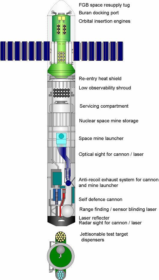
Para matar a curiosidade, eu dê uma vasculhada em alguns dos satélites que estão no Brasil neste momento.
Contribuições para o projeto.
PIX +5561998487514
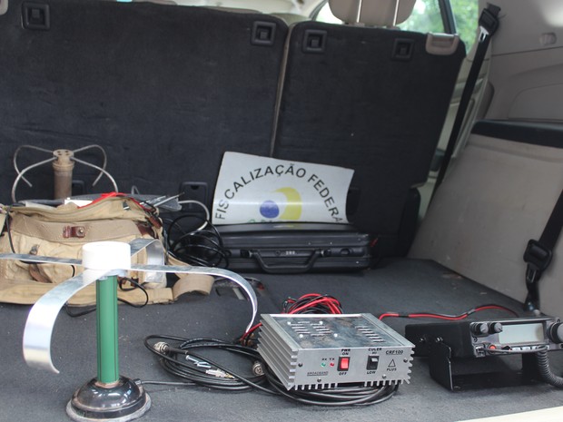 Rádio clandestino estava instalado em caminhão (Foto: Catarina Costa/G1)
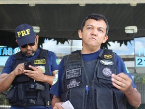 Inspetor da PRF explica que rádio clandestino é
 Caminhoneiro foi preso com rádio clandestino na


 Tea B
Tea B
 Mark Dammer MM0DQM
If only you could use English so everybody could understand you ?